Marine resources
Published community and reference material. 93 items · page 1 of 4. Submit a resource →
Help the marine community
sail safer, smarter.
Every chart, guide, safety briefing, or navigational note you share becomes a reference for mariners worldwide. Our library grows entirely through community contributions.
Share your knowledge
Upload charts, safety guides, passage plans, tide tables, or any resource useful to fellow mariners. Takes less than 2 minutes.
Upload a resourceView the Marine Hub →93
Published resources
You are browsing this★ Popular
 Resource
ETA Calculator: Arrival Time by Speed and Distance
Work out the ETA from speed and distance, the speed needed for a wanted arrival, or the distance you can cover by a date. Ports with their time zones and daylight saving applied.
231 Resource
MF/HF DSC Coast Stations with MMSI (GMDSS Test Stations)
MF/HF DSC coast radio stations worldwide with MMSI numbers and frequencies for GMDSS equipment tests: find the nearest test station, its MMSI and the frequencies it answers on.
125 Resource
True Wind Calculator
True Wind Calculator
Shared by@adminContributor
218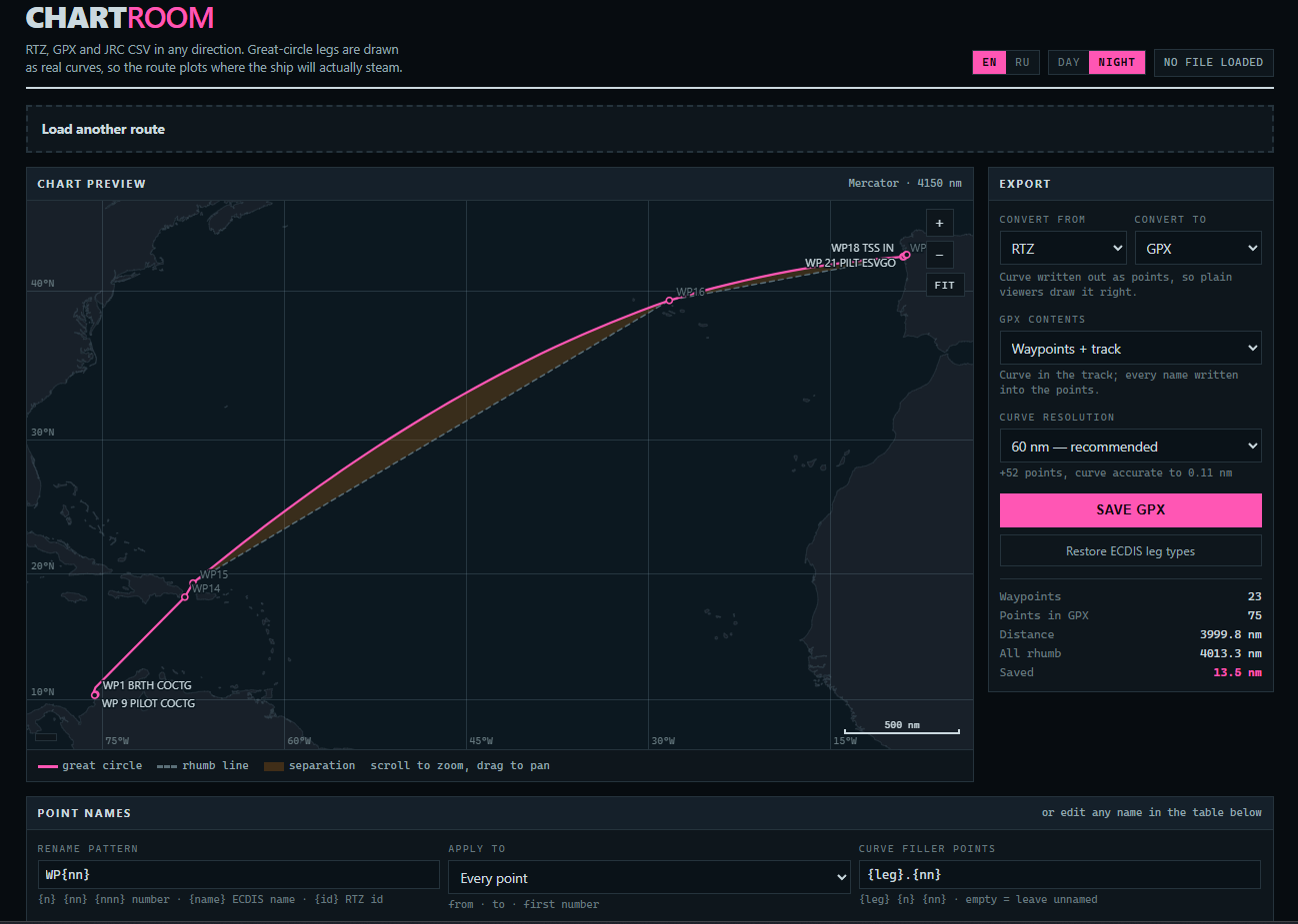 Resource
Chartroom - Route converter RTZ, GPX & JRC CSV
RTZ, GPX and JRC CSV in any direction. Great-circle legs are drawn as real curves, so the route plots where the ship will actually steam.
Shared by@Kirk_roContributor
2310 Resource
Marine VHF Channels and Frequencies (Full List)
Every marine VHF channel with its ship and coast station frequencies: channel 16 and 70, port operations, duplex and simplex channels, US and international use. The table mariners look up before calling.
29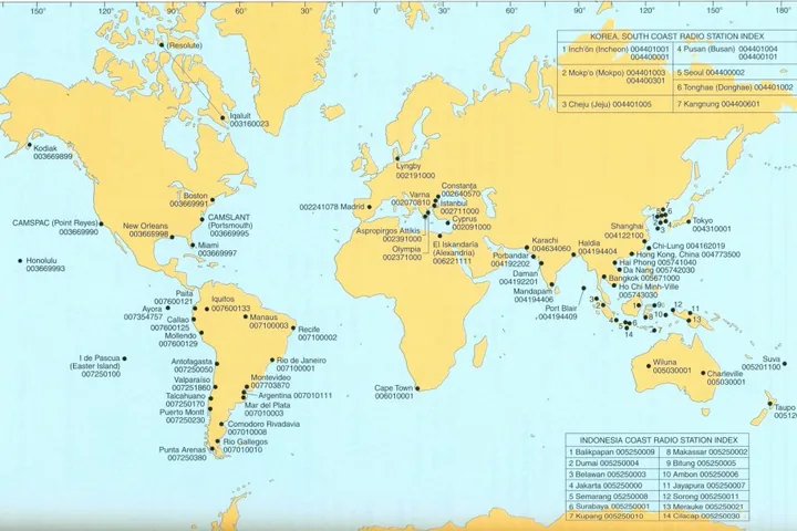 Cheatsheet
HF Stations
Cheatsheet
3857- Other
ENP133C- 2024 ADMIRALTY ENC AND ECDIS Maintenance Record
ENP133C- 2024 ADMIRALTY ENC AND ECDIS Maintenance Record Log book scanned pages.
6167 - Leisure marine
LSA CODE EDITION 2024
LSA CODE EDITION 2024
4465
 Resource
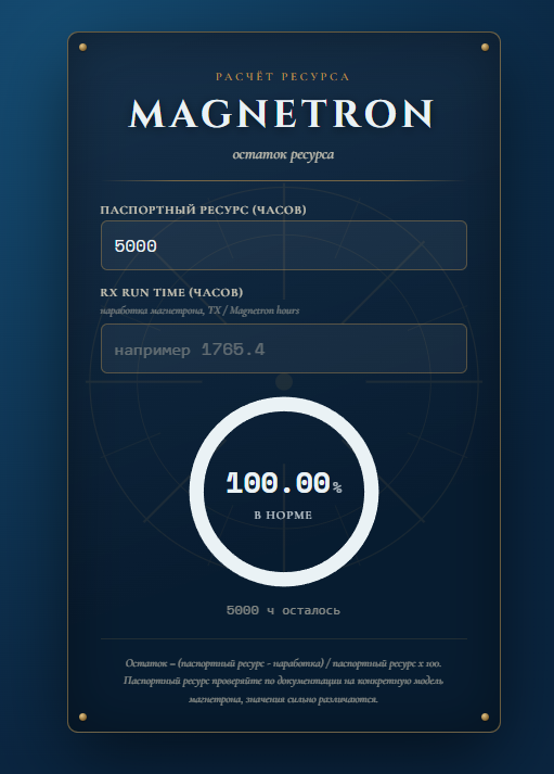
Magnetron life calculator
Service Life Calculation MAGNETRON Remaining Service Life
Shared by@Kirk_roContributor
232- Resource
Chartroom - Route converter RTZ, GPX & JRC CSV
RTZ, GPX and JRC CSV in any direction. Great-circle legs are drawn as real curves, so the route plots where the ship will actually steam.
Shared by@Kirk_roContributor
2310 - Resource
Marine VHF Channels and Frequencies (Full List)
Every marine VHF channel with its ship and coast station frequencies: channel 16 and 70, port operations, duplex and simplex channels, US and international use. The table mariners look up before calling.
29  Resource
COLREGS 1972 - Interactive Reference to International Regulations for Preventing Collisions at Sea
A complete interactive reference to the International Regulations for Preventing Collisions at Sea (COLREGS 1972), covering all rules, annexes, and articles. Designed for deck officers, mariners, and maritime students who need quick access to collision regulations, steering and sailing rules, light and shape requirements, and sound signals.
21- Resource
True Wind Calculator
True Wind Calculator
Shared by@adminContributor
218
- Chart
CJK TSS FURUNO
CJK Traffic Lane - Changjiang (Yangtze) Estuary vessel traffic separation scheme, East China Sea approach lanes, FURUNO ECDIS userchart
372 - Other
INTERNATIONAL CONVENTION FOR THE CONTROL AND MANAGEMENT OF SHIPS' BALLAST WATER AND SEDIMENTS, 2004 - North Sea
North Sea Ballast Water Exchange Area, BWM.2/Circ.56,BWM.2/Circ.63
710 - Other
Bearing Repeater Compass Type 133-407 Operator Manual - Anschütz Navigation Equipment
Official operator manual for the Anschütz Bearing Repeater Compass (Type 133-407), a precision maritime navigation instrument manufactured by Raytheon Marine GmbH. The manual provides comprehensive operating instructions for ship officers and crew responsible for navigation and heading monitoring. It covers switching on/off procedures, heading indication signals from both gyro and magnetic compass
2160 - Route information
Finland’s winter navigation Instructions for winter navigation operators
Finland’s winter navigation Instructions for winter navigation operators 2024-2025
510 - PDF
Canadian Sailing Directions Gulf of St. Lawrence (Southwest Portion)
Canadian Sailing Directions Gulf of St. Lawrence (Southwest Portion)
210 - PDF
Guidelines for the Control of Drugs and Alcohol in the Maritime Industry (Third Edition 2024)
Comprehensive guidelines issued by the Oil Companies International Marine Forum (OCIMF) for managing drug and alcohol control programs in the maritime industry. This third edition (March 2024) provides updated recommendations for ship operators, terminal operators, and maritime companies on developing and implementing effective drug and alcohol policies, standards, and procedures. The document cov
710 - Chart
Busan VTS, approaches FURUNO
User Chart for FURUNO ECDIS, Busan VTS, approaches, reports
350 - Chart
RIO DE LA PLATA - PARANA RIVER
Userchart for Parana River for JRC ECdis
330 - PDF
CONVENTION FOR THE SUPPRESSION OF UNLAWFUL ACTS OF VIOLENCE AGAINST THE SAFETY OF MARITIME NAVIGATION (SUA CONVENTION)
SUA CONVENTION AND 2005 PROTOCOL TEXT
1040 - Other
CERTIFICATE OF WATCHKEEPING FOR CHIEF MATE'S OR MASTER'S CERTIFICATE
Format of Anglo Eastern CERTIFICATE OF WATCHKEEPING FOR CHIEF MATE'S OR MASTER'S CERTIFICATE
640 - PDF
Navi-Planner 4000 User Manual - Maritime Navigation Planning Software
Navi-Planner 4000 User Manual - Maritime Navigation Planning Software
350 - Safety information
LISTS OF NAVAREA AND METAREA COORDINATORS
LISTS OF NAVAREA AND METAREA COORDINATORS 1 In consultation with the International Hydrographic Organization (IHO) and the World Meteorological Organization (WMO), updated lists of NAVAREA and METAREA Coordinators have been prepared, as set out in annexes 1 and 2, respectively.
430 - Other
ENP133C- 2024 ADMIRALTY ENC AND ECDIS Maintenance Record
ENP133C- 2024 ADMIRALTY ENC AND ECDIS Maintenance Record Log book scanned pages.
6167 - Chart
Various user charts and routes
Various user charts and routes, TRANSAS includ: Ports & Terminals: Yokkaichi, Yokohama, Mailiao, Hongkong, Dalian, Incheon, Changzhou, Yeosu, Taichung, Ulsan, Mokpo, Daesan, Dushan, Etajima, Jinhae, Nghison, Zhenjiang, Singapore, Kolkata, Maptaphut, Sriracha, Nantong, Taican, Mumbai, Pipavav, Hazira, Port Dickson, Kunsan, Pyongtaek, Pyeongaek, Bataan, Pasir Gudang, Bangkok, Cagayan, Kaohsiung, C
1160 - Safety bulletin
GUIDELINES FOR SHIPS OPERATING IN POLAR WATERS
GUIDELINES FOR SHIPS OPERATING IN POLAR WATERS
440 - Other
IMS UPDATE
IMS UPDATER DATA AVCS
310 - Safety information
IMO GMDSS Manual (2024)
Last Edition of GMDSS Manual published by IMO. Contains all essential information regarding distress alerting, GMDSS structure, coastal stations and SAR procedures.
2990 - Resource
MF/HF DSC Coast Stations with MMSI (GMDSS Test Stations)
MF/HF DSC coast radio stations worldwide with MMSI numbers and frequencies for GMDSS equipment tests: find the nearest test station, its MMSI and the frequencies it answers on.
125 - Resource
ETA Calculator: Arrival Time by Speed and Distance
Work out the ETA from speed and distance, the speed needed for a wanted arrival, or the distance you can cover by a date. Ports with their time zones and daylight saving applied.
231